
Where Scórtol works
Scórtol works wherever its trail data is loaded, and the covered area grows over time. Today it is the Alps and Slovenia. Anywhere inside the highlighted area on the map you can drop a start point and generate loops. Below are the countries and some of the best-known areas within reach.
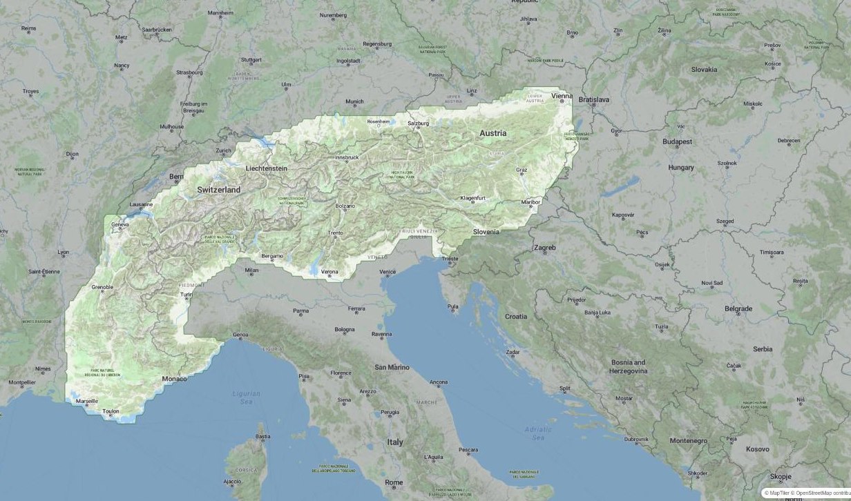
Countries
- Italy
- Austria
- Switzerland
- Slovenia
- France
- Germany (Bavarian Alps)
Notable areas
Dolomites
Trentino-Alto Adige & Veneto, Italy
Mont Blanc massif
France / Italy border
Bernina Range
Engadin, Switzerland / Italy
Julian Alps
Slovenia / Italy
Ortler Alps
South Tyrol, Italy
Brenta Dolomites
Trentino, Italy
Hohe Tauern
Austria
Ötztal Alps
Austria / Italy
Karst & Val Rosandra
Trieste, Italy / Slovenia
Friuli coast & lagoons
From Trieste to Grado and Lignano, Italy
Coverage is defined by the loaded map data, not by borders — the highlighted area on the map is always the source of truth for exactly where routes can be generated. Missing your region? Tell us from the map's ⓘ menu: requests decide where we go next.
Ready for your next loop?
Drop a start point on the map and let Scórtol do the planning.
Open the map